
There is a philosophy pertaining to visiting a town that makes tourism unique and interesting: Always look for the most uncommon and unvisited places first before visiting the main attractions. They have the most valuable information and features that will make you leave town knowing a bit more than before.
Glauchau, located in western Saxony approximately 20 kilometers west of Chemnitz and 13 kilometers north of neighboring Zwickau is a typical farming community. Yet despite having 23,000 residents, the community, which has a historic city center and two castles, is known for its serenity, as there is not much activity directly in the city, but more in the areas full of green, thanks to its parks, the Glauchau Reservoir and the green areas along the Zwickauer Mulde River.
And while I was there for an interview for a teaching position at an international school, I was reminded of the philosophy mentioned at the beginning, when it came to relics of the past. While the community was once a pub for the textile industry, it also has a set of historic bridges that are worth visiting. One of which was a viaduct spanning a street and valley, which provided a spectacular view of the northwestern end of Glauchau. Once crossing that enroute to the interview and realizing that I had a long waiting time to catch the returning train to Jena in Thuringia, it became my mission to see what other bridges are worth the visit. And sure enough, enough diamonds in the rough were discovered, which were enough to justify constructing a tour guide showing the readers where these bridges can be found and thus encouraging people to visit them in addition to the town's historic city center. A map and link to a gallery of photos can be found at the end of the article.
 Lungwitzbach Railroad Viaducts:
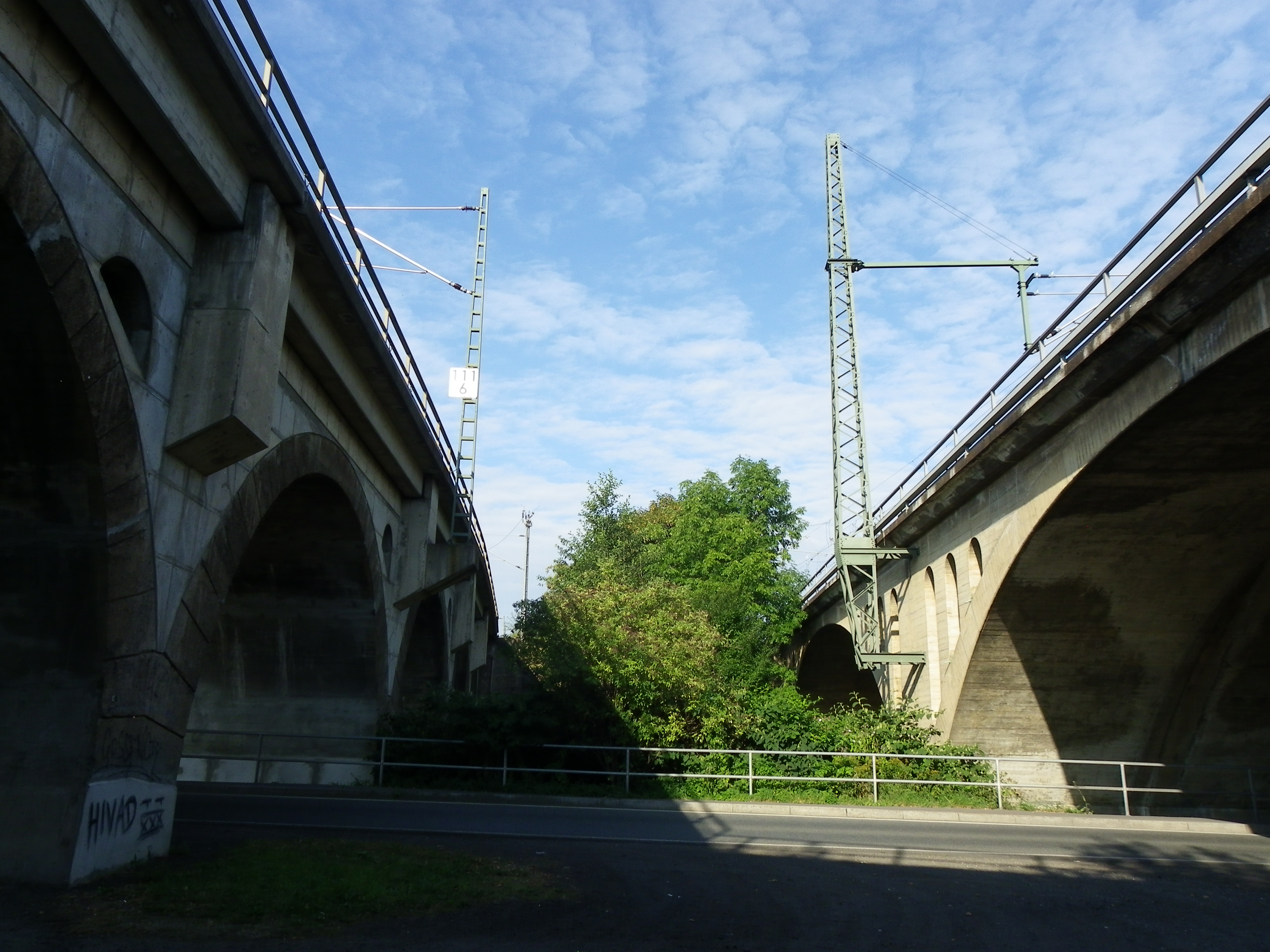
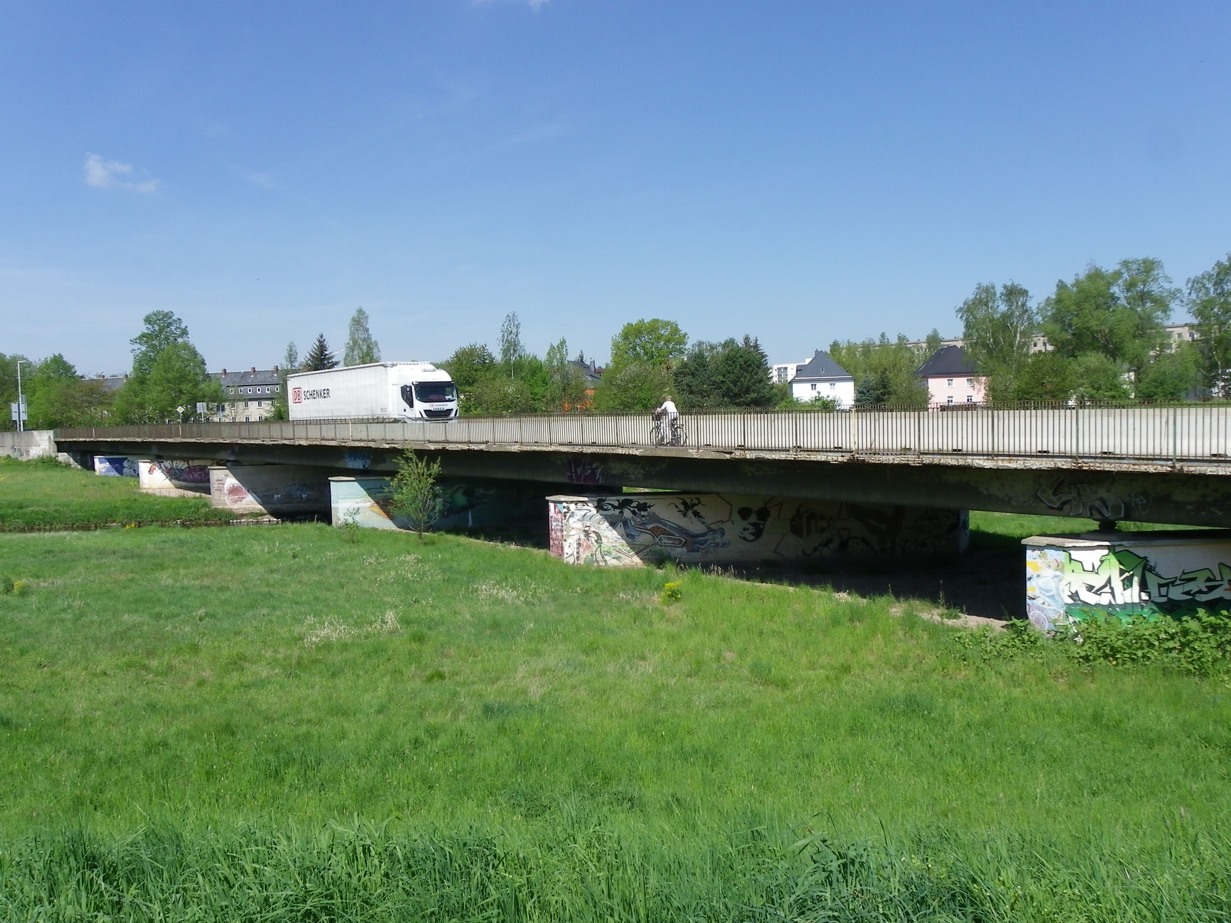
When arriving at Glauchau Railway Station from Dresden and Chemnitz, this bridge pairing will greet you, as you cross Lungwitzsbach Creek and the parallel street leading to St. Egedien. Both structures are at least a century old, but each one having a different design and built using different materials. The sandy grey structure with dark brown arches is the most heavily traveled and also the oldest of the two, having been built in the 1860s and is part of the magistrate connecting Dresden with Zwickau and Hof. The bridge has seven arches and and each spandrel is partially closed, for half-circle openings appear, one on each end of the arch. The bridge appears to have been rehabilitated between five and ten years ago, with the line being electrified and the bridge strengthened to provide more trains along the line. One can see the work with the concrete shelves sticking out between the arches, where each overhead pole sits.
The sandy brown colored bridge next to it features a three-span open spandrel arch bridge, totaling three spans. The spandrels have an arch top- for each arch span, there are three spandrels on each side. That structure only serves freight traffic although it had previously served a railway line along the Zwickauer Mulde, connecting Penig, Rochlitz and Grimma. Both bridges are about 200 meters long and have two tracks each. It is unknown who was behind the design and construction of the two bridges, but they are considered the longest in Glauchau and ones that are a must-see when spending time there.
[gallery ids="647,646,643,642" type="slideshow"]
***********
[gallery ids="1871,653,651,652,650" type="slideshow"]
Am Schafteich Railroad Bridge:
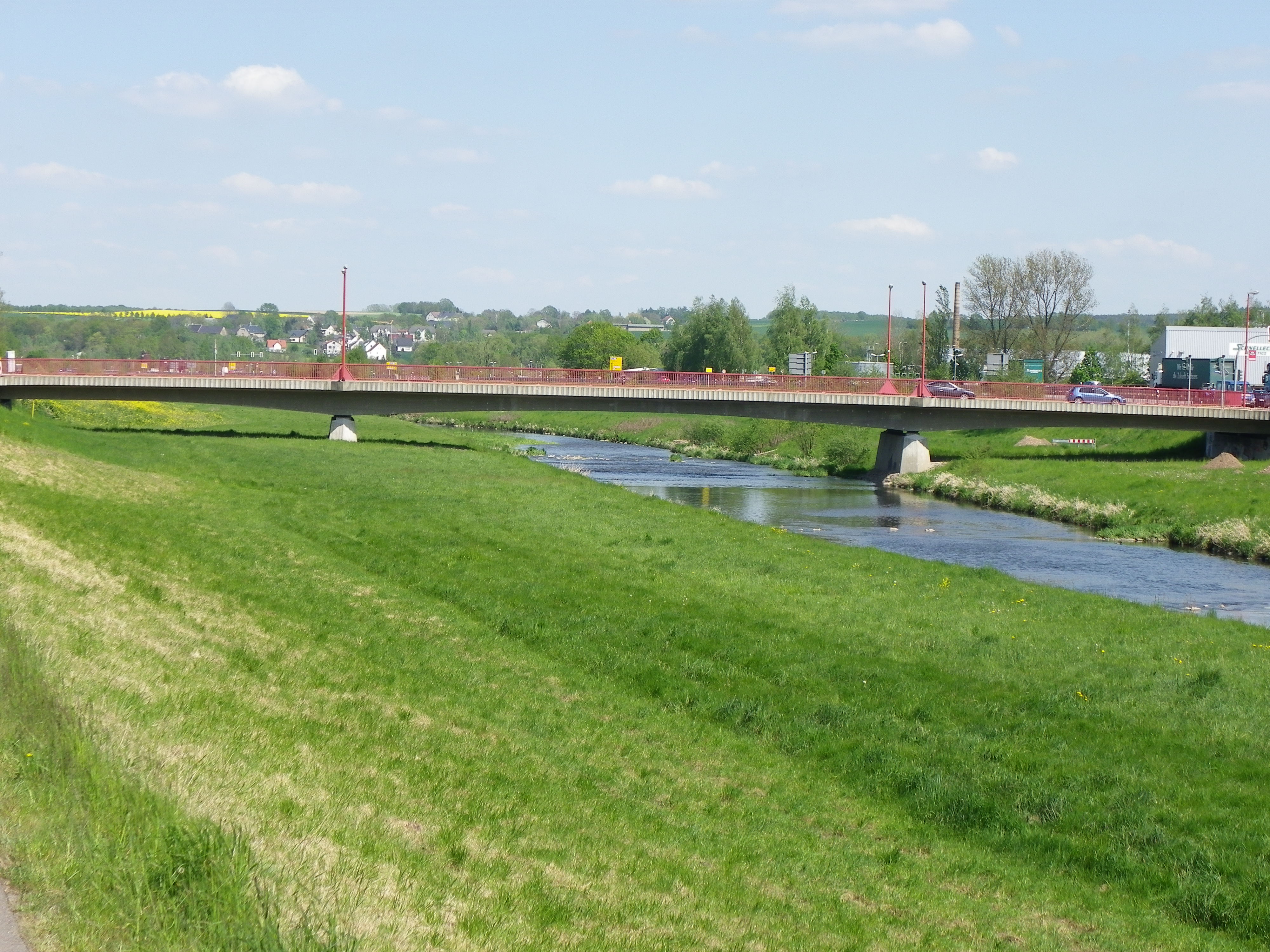
Spanning the Zwickauer Mulde River, this bridge is the nearest of the two arch bridges to greet passengers when entering Glauchau Railway Station from the west (Erfurt, Meerane and Zwickau). This bridge is the gateway to the industrial park, where automobile parts are produced for Volkswagen, whose production facility is located between Glauchau and Zwickau. The structure features three closed spandrel arch spans, the longest (which spans the river) is built using limestone and is about 80 meters. The side arches are built using sandstone and limestone, thus creating a unique color and pattern combination. Each of the spans are about 30 meters, one of which crosses the street. The bridge is the most difficult to photograph because three fourths of the structure is on private property and is fenced off. The last fourth features trees, tall bushes and no sidewalk, thus the risk is great when photographing the structure, as you can see in the pics. The bridge is at least 120 years old but serves the magistrate between Dresden and Hof via Zwickau but also the line between Erfurt and Glauchau. This line is part of the planned Mitteldeutschland Route, connecting Chemnitz with Cologne via Erfurt, Kassel and Gera. It is expected that InterCity trains will start serving the line by 2023, thus making Glauchau a train stop for long-distance trains for the first time since 2006.
*********
[caption id="attachment_1831" align="alignnone" width="1885"]

King Albert Bridge before its replacement in 1955. Photo courtesy of Ulrich Schleife[/caption]
King Albert Bridge (a.k.a. Lower Mulde Bridge)
When traveling west on Auer Strasse in the direction of Gesau, you will not recognize the bridge after you cross it, going past the beverage store Getränkewelt on the left side. If anything, it is just a typical beam bridge with railings, that's all. You will also not recognize its historic appearance unless you do one of the following:
1. Pull into the parking lot of the beverage store, go into the Mulde, swim underneath the bridge and get a shot on the opposite end (as the front side has another bridge carrying a pipeline over it.
or
- Cross the street onto the flower bed of a nearby proprietor, walk the line along the curb bordering the flower bed (without stepping into it) and get an oblique shot from the building.
Being dressed in a suit with no SCUBA equipment for a special occasion, I elected the second option, even though it would have been funny and interesting to try the first option.

But the photo opportunity is well worth it.
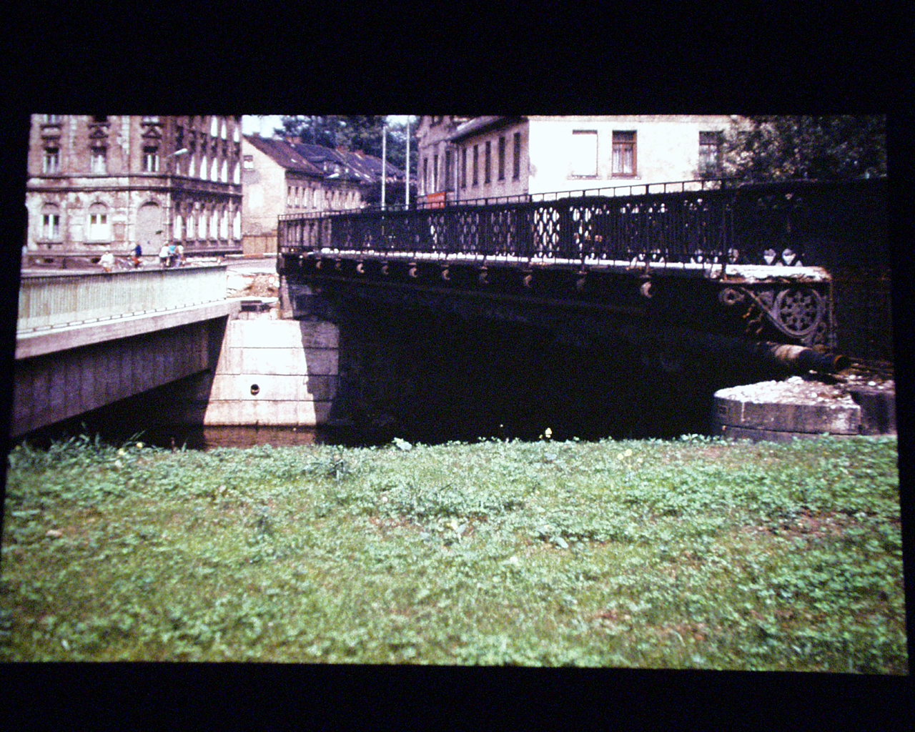
The current structure, built in 1955, is a single-span stone arch bridge, carrying a concrete decking. Given the scarcity of materials needed for bridge building because of the after-effects of World War II combined with the Soviet occupation of the eastern half of Germany, many of the new structures were constructed using concrete and/or with minimal quality and using either beam or truss structures. This bridge was probably built using stone bricks that originated from the Ore Mountains (Erzgebirge) and was cut on site to fit the structure that is 35 meters long and 25 meters wide.
Its predecessor however consisted of a Parker through truss bridge built in 1888 and was, according to local historical accounts, one of a few Glauchau bridges built by Heinrich Carl Hedrich. The bridge featured riveted connections among the trusses, v-lacing on its overhead bracing and upper chords and a vertical endposts. Also included were ornametal lampposts on both ends of the bridge, featuring spirals and spherical shapes with an oval-shaped glass cover for lighting.
[caption id="attachment_1833" align="alignnone" width="1246"]

Postcard of the bridge before World War II. Courtesy of Ulrich Schleife[/caption]
The bridge's original wood decking was replaced in 1927 with a combination of concrete and brick to accommodate increasing traffic loads. 11 years later, a new coating of paint was needed, which kept the bridge from rusting and thus prolonging its lifespan. Sadly, even though the bridge survived two World Wars, it was closed to traffic in 1954 because of rust and corrosion on the trusses, including the lower chord. At the same time, plans for a new bridge commenced, which was realized one year later.
The King Albert Bridge,
named after the King of Saxony who was also the member of the House of Wettin, may be just a typical bridge for the City of Glauchau, yet never judge it by its appearance just by crossing it. The treasure can be found in the water, whose historic value will make the writer and historian think twice before writing it off as a typical piece of concrete over a body of water.
*******
[gallery ids="340,339,336,335" type="slideshow"]
Gründelteich Bridge and Statue
Located at the southeast end of Gründelteich pond near the Hintere Glauchau Castle, this bridge has been in service since the 1880s as it served as the lone access to the island. The history behind the island is that it was named in honor of
Heinrich Carl Hedrich (1816-1900), who spent most of his life in Glauchau and left a mark in the city's history. Hedrich was responsible for the rechanneling of the (Zwickauer) Mulde while reconstructing the dam that had been destroyed by flooding in 1839. Furthermore, he invented Germany's first modern water main system running through the community, providing drinking water to the households, while also channeling water away from the Zwickauer Mulde. In addition to the construction of the mills and dams, Hedrich harnessed electricity through hydroelectric power. The people in Glauchau benefitted from his inventions, and Hedrich was awarded with a head statue and an monument with a golden angel in 1884, about the same time this bridge was built. The
decking, railings and piers appear to be at least 45 years old, yet the design of the bridge is the
same as the original built in 1884.
******
[caption id="attachment_1834" align="alignnone" width="1280"]
Upper Mulde Bridge- the replacement bridge (left) and the original bridge with ornamental railings on the right side. Photo courtesy of Ulrich Schleife[/caption]
Meeraner Strasse (Upper Mulder ) Bridge
The Meerane Strasse is one of two major streets that have bridges crossing the Mulde River and its diversion arm (Flutgraben). This bridge is located at the junction with Lindenstrasse and by first glance, one will see a typical 90s style concrete deck girder with vertical lining and orange railings. A rather bland structure unless you have a quick blick at the abutments of an older bridge on the right hand side going west towards the Flutgraben crossing. That bridge had a history of its own as it was a steel pony girder bridge with Town Lattice truss features. Ithel Town created this unique truss design in 1820 that consisted of interwoven diagonal beams. This truss type was common on many wooden covered bridges in the United States, but also among many metal truss bridges in Europe, especially those carrying rail traffic.
The Meerane Bridge was constructed back in the 1880s and was claimed by historic resources to have been built by Heinrich Carl Hedrich. Yet the exact date of construction remains unknown. It is known that the structure, which was about 35 meters long and 15 meters wide, was replaced at the time of the Fall of the Berlin Wall because of age and structural deterioration. A concrete bridge was built alongside the old structure, thus allowing for the continuation of traffic between Glauchau and Meerane on the old one. After traffic was diverted onto the new structure, the old one was removed and scrapped.
[gallery ids="1836,1837,1838,1835" type="slideshow"]
*******
THE THREE BRIDGES TO THE "HOLY LAND"
While Glauchau has eight bridges and a dam spanning the Mulde and its diversion canal Flutgraben, one unique feature that makes the city special are the bridges on the hill leading to its historic city center and castles. Dubbed as the Bridges to the Holy Land, each of the three spans consist of arch bridges crossing deep gorges that serve as drainage to the Mulde. Each of the gorges are approximately 20-25 meters deep. From the flood bed of the Mulde, the height of the bridges is approximately 75 meters high, and given the fact that Glauchau was once a walled city and it has a strong religious core- laden with a variety of denominations- one could christen the name of the bridges along Otto-Schimmel-Strasse and Leipziger Strasse between the train station and the castles "The Three Bridges to the Holy Land," named after the Three Wise Men who brought Baby Jesus gifts and blessed Him on what it today called Day of Epiphany (January 6th). Yet that interpretation would be a bit far-fetched if one is either a non-denominational or an atheist.
Even though one of the arch bridges no longer exists (Nicolas Tower and Bridge), all three bridges still serve it purpose of serving traffic and providing commerce to the city center. We will look at all three bridges going towards that "Holy Land", beginning with the youngest and longest of the three.
[gallery ids="1877,1876,1875,1874,323,317" type="slideshow"]
Scherberg Bridge
Spanning Talstrasse at Otto-Schimmel-Strasse and Leipziger Strasse, the Scherberg Bridge is a cross between modernitity and history as the 1920s structure features a concrete closed spandrel Luten arch main span and two circular mini-spans implanted in the wingwall on each side. Furthermore, Art Greco patterns can be seen in the main arch span. A shield representing the City of Glauchau can be seen on the east end on the right of the main arch span. Construction started in 1921, and despite two harsh winters, combined with a lack of personnel and high inflation upping the cost for the bridge because of the aftereffects of World War I and the Marseilles Treaty respectively, the bridge was dedicated on 29 April, 1923. The bridge was deemed a necessity because of the need to connect the city center and the train station, which was completed three years after the bridge opened. Prior to the bridge, accessing the city center was as difficult as Moses climbing the Mountain to meet God and receive the 10 Commandments. Delivery with horse and buggy had to be made by zigzagging up several streets and dealing with gorges and other obstacles. The plan for the bridge had been created in 1909 but work never commenced because of the war, plus hefty discussions regarding the necessity of the bridge. Despite all the aforemetioned adversities affecting Glauchau, the city mayor Otto Schimmel had the final word in favor of the bridge, which has a total length of 97 meters (the main span is 35 meters), 14 meters wide and 28 feet above Talstrasse. The bridge was rehabilitated in 2011, which included repairs to the structure, new decking and lighting and new paint- especially with the shield. The bridge may look just like new, but the 94-year old structure is one of the symbols that represent the city of Glauchau. The Scherberg Bridge serves as a posterboy for other arch bridges of this caliber that exist in the US and elsewhere, many of which are in danger of being demolished and replaced.
[gallery ids="1886,1885,1884,1883,1882,1872" type="slideshow"]
Gottessackbrücke (a.k.a. Postbrücke)
The next bridge along the Road to the Holy Land is the Postbrücke. Spanning another gorge (which is accompanied with a path down to the residential area) carrying Leipziger Strasse, this masonry stone arch bridge is the shortest of the three bridges, having a span of 15 meters and a width of 12 meters. Built in 1887, it is located next to the historic post office, which had existed much longer than the bridge itself. Apart from some minor structural work on the bridge, the Postbrücke has maintained its historic integrity, while serving traffic between the city center and the district of Gottessack (God's Sack), north of the structure. The area features several historic, but empty buildings that are ripe for restoration and reuse, making Glauchau even better than it is now.
[gallery ids="1887,1888,1889,1890,1891,1894,1893,1892,1879,1878,1880" type="slideshow"]
Nicolas Tower and Bridge
The last bridge going to the city center is the Nicolas Tower and Bridge. While no date has been pinpointed to the bridge, it was believed to have been just as old as the tower itself. The Nicolas Tower served as the main entrance to the city center, which had once been walled on all sides, with watch towers and the castles that were included. It is safe to say that the entrance to the walled town was through the Hintere Schlossbrücke on the south side (still extant) and the Nicolas Tower and Bridge on the north side. While the tower may have been built during the Medieval era as part of the project to make Glauchau a walled city, records indicated that the tower was rebuilt from the ground up in 1741. It featured a living quarters above the gate, where the watchman and his family lived, and was later decorated with a church bell by the Lord Albert Christian Ernst in 1758. A clock was later added to the gate. Because of its narrowness combined with the increase in traffic and damage caused by lightning and high winds, the tower was replaced in 1890, but the bridge itself remained in service until 1965. A mural depicting the tower can be seen at the site where it once stood as you cross the bridge, yet a mini-replica can be found in the city museum.
[caption id="attachment_1873" align="alignnone" width="4000"]

Remains of the watch tower and the walls of the historic city on the northwest corner (JS)[/caption]
The Nicolas Bridge featured two different arch bridges- one made of concrete and one made of brick, whereas the former may date back to the time of the castle and the brick span was later added in the early 1800s. The bridge also featured a series of steps to encourage people walking along the path along the creek to use it to go to the bridge and the city center. Sadly, due to structural damage caused by bombings in World War II and later deterioration because of the increase in automobile traffic, the bridges had to be demolished in 1965. The older arch was first removed, followed by the other arch as soon as the replacement structure was in place and opened to traffic. It is hard to believe that, despite looking like a bridge built in the 1990s, today's structure is 52 years old. But part of that was because of the rehabilitation work done in 2003-4 to keep the 33.3 meter long bridge open to traffic. Its width of 19.6 meters include 6.1 meters for pedestrians, and its height of 9 meters above the gorge provides viewers with a glimpse of the gorge and the valley of the Mulde, filled with houses and green landscape. The bridge provides good commerce as many stores line up along the street between the bridge and the Postbrücke, but also towards the city center.
******
[gallery ids="326,325,324" type="slideshow"]
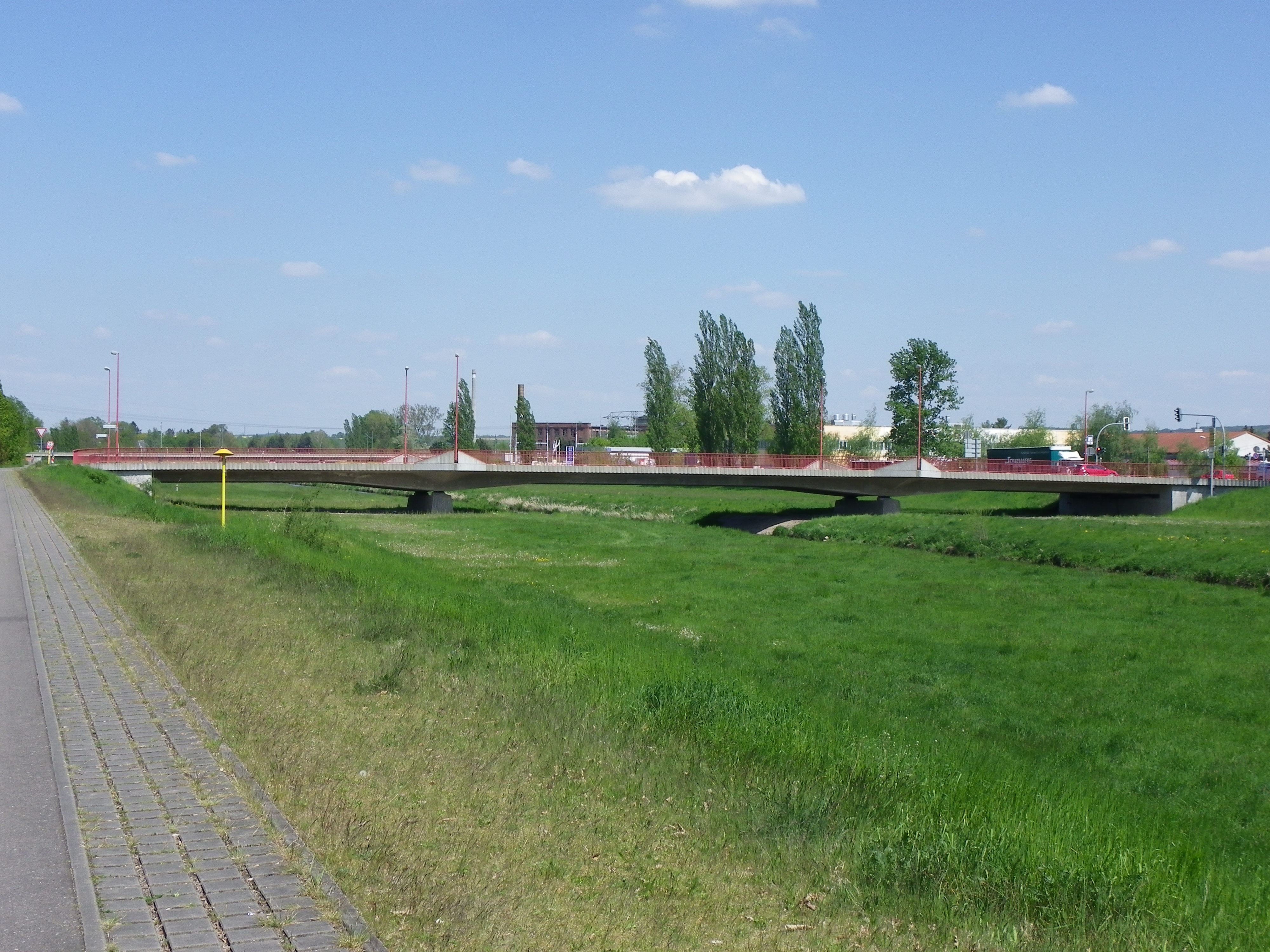
Waldenburger Viaduct
The Waldenburger Viaduct is one of three stone arch viaducts serving the rail lines passing through Glauchau. All of them appear to have been built in the 1860s as the rail lines between Glauchau and Werdau were established. This bridge features three arch spans- the center for vehicular traffic, the outer for the cyclists and pedestrians. With the renewed electrification of the line in the early 2000s, this bridge was renovated as part of the plan to reintroduce InterCity trains between Chemnitz and Cologne via Jena, Erfurt and Kassel. By 2023, InterCity trains are expected to stop in Glauchau from Hof (South), Dresden (East) and Cologne (West). Until then, passengers have only the regional trains connecting the town with Meerane, Gößnitz and Gera to the west as well as those going to Zwickau and Aue to the south and those going to Chemnitz and Dresden to the east, to contend with. But subtracting that, the bridge is one of the nicer structures to visit while in Glauchau but one that stands out in the face of buildings that are victims of either neglect or modernization. If one can detect this bridge early, it is not a miss. Otherwise, it is drowned out by these factors.
******
[gallery ids="641,640,639,638" type="slideshow"]
Zimmerstrasse Covered Bridge:
Located behind the Wehrdigtschule, this bridge is an easy miss if one goes past it along Lindenstrasse. But its history dates back to the 19th century, when the establishment of factories and residential areas to the west of town necessitated the need for crossings over the Mulde. This crossing was one of four that were built under the direction of Hedrich (the same person responsible for the modern water main lines, mills and the dam), but six additional ones were built after the turn of the century. While the original crossing was most likely destroyed in World War II, this bridge took its place many years later. Between 15 and 25 years old, this wooden Pratt truss bridge is quite modern for a covered bridge but one that gives the nearby schools at Wehrdigt and the Saxony International Elementary School some charm, especially as children and teachers can utilize this crossing for safety and receational purposes.
This bridge was the lone structure I could not find during my first trip through Glauchau, but I recently visited the bridge in September during a tour to Zwickau and found some details worth noting: The bridge is made of wood but with steel bracing, and the connections are pin-connected, some of which featured steel gusset plates embedded into the wooden beams and then bolted with steel, as you can see in the picture above. One cannot see that with other covered bridges unless it's modern, thus supporting my previous argument of its age. In either case, the bridge is heavily used, especially by school children. :-)
******
[caption id="attachment_321" align="alignnone" width="4000"]
Hintere Glauchau Castle Viaduct[/caption]
Hintere Glauchau Castle Viaduct:
Located at the southern entrance to the Hintere Glauchau Castle, this five-span concrete and stone arch bridge spans a deep valley and judging by the appearance, is perhaps the oldest bridge in Glauchau, having been built at the same time as the castle itself in the 14th Century. The structure was needed to provide passage into and out of the castle, while the valley floor used to be a moat, used to keep intruders from attacking the castle from the outside. Today's bridge serves pedestrians, but given its appearance, it would cause an American bridge builder to sound off the alarm regarding structural deficiencies, calling for the demolition and replacement with something resembling a bridge at Walt Disney World in Florida. Fortunately, engineers recognize the bridge's importance and have been working to stabilize the structure, while at the same time, maintain its original form. However, planning is in the works to
rehabilitate and restore the bridge to its original form, although this multi-million Euro project is years in the making, especially as money had been spent on a new bridge at Wernsdorf.

******
[caption id="attachment_332" align="alignnone" width="4000"]
Fordere Glauchau Castle Bridges[/caption]
Fordere Glauchau Castle Bridges:
Consisting of two stone arch bridges, these crossings were part of the original Fordere Castle that was built in 1470 and is still considered the oldest Rennaissance castle in the region. Not much has been written about the castle's history except for the fact that there were three periods of construction involving this Baroque-style castle: between 1470 and 1485, between 1520 and 1534 and in the 18th and 19th Centuries. The Hintere Castle was constructed in the 16th Century, however its viaduct to the castle dates back to the 14th century. The two bridges were built during the second period and was most likely renovated during the third phase. In either case, the crossing served its purpose of allowing people to enter and exit the castle without having to worry about drawbridges over moats or even trying to ford the crossing. The crossings are only 20 meters apart, still though, they also serve as a good observation deck, where one can see much of Glauchau and its landscape as far as the eye can see. As the castles and the city center are on a high hill, that serves as a big advantage for tourists and photographers alike. :-)
*******
Flutgraben Crossings:
Also noteworthy of the tour in Glauchau are the crossings along the Flutgraben. The diversion canal bypasses the city on the west side, extending from the north end east of Jerisau Bridge down south to the Glauchau Reservoir, a distance of six river kilometers. And while there are four crossings that are either as long or longer than the Scherberg Bridge, there is a sad history that is in connection with the Flutgraben. On 31 July, 1858, high water from the Mulde devastated much of the residential areas in Glauchau, causing enough damage to make the houses and apartments unliveable. It was afterwards that the city decided to construct a diversion canal, bypassing Glauchau to the west to alleviate the flow of water in the event of the flooding. Construction lasted until 1890 but not before having removed as many as seven dozen houses, buildings and other properties- many of them were empty or unliveable. The width of the canal is the same as the river itself, yet the flood plain is four times as wide as the canal, and with a depth of 3-4 meters, it would accomodate unusually high flows of water.
Four bridges span the Flutgraben, including the railroad bridge that carries both the Dresden-Hof-Nuremberg Magistrate and the Glauchau-Jena-Erfurt rail line. The Nordufer Bridge at Auer Strasse is the oldest remaining bridge along the canal, while the Meerane and Jerisau Bridges were built in the late 1990s and still accomodate major traffic in and out of Glauchau. Additionally, a dam at the Reservoir, dating back to the 1930s is still in use to control the flow of water from the Mulde. Here is a brief summary of each one:
[caption id="attachment_327" align="alignnone" width="4000"]
Nordufer Bridge[/caption]
Nordufer Bridge:
At over 200 meters spanning the outer channel of the Mulde, the Nordufer Bridge is the oldest of the existing bridges along this channel. As a key link to Zwickau, it is also the busiest as 30 vehicles cross the bridge per minute. The 50+ year old bridge, which is characterized by its expansion and contracting rollers, has shown significant signs of wear and tear with cracks and spalling appearing on the girder spans. It is likely, given its approximate location near the industrial area and the Saxony International School, it will be replaced in the next decade.
[caption id="attachment_328" align="alignnone" width="4000"]
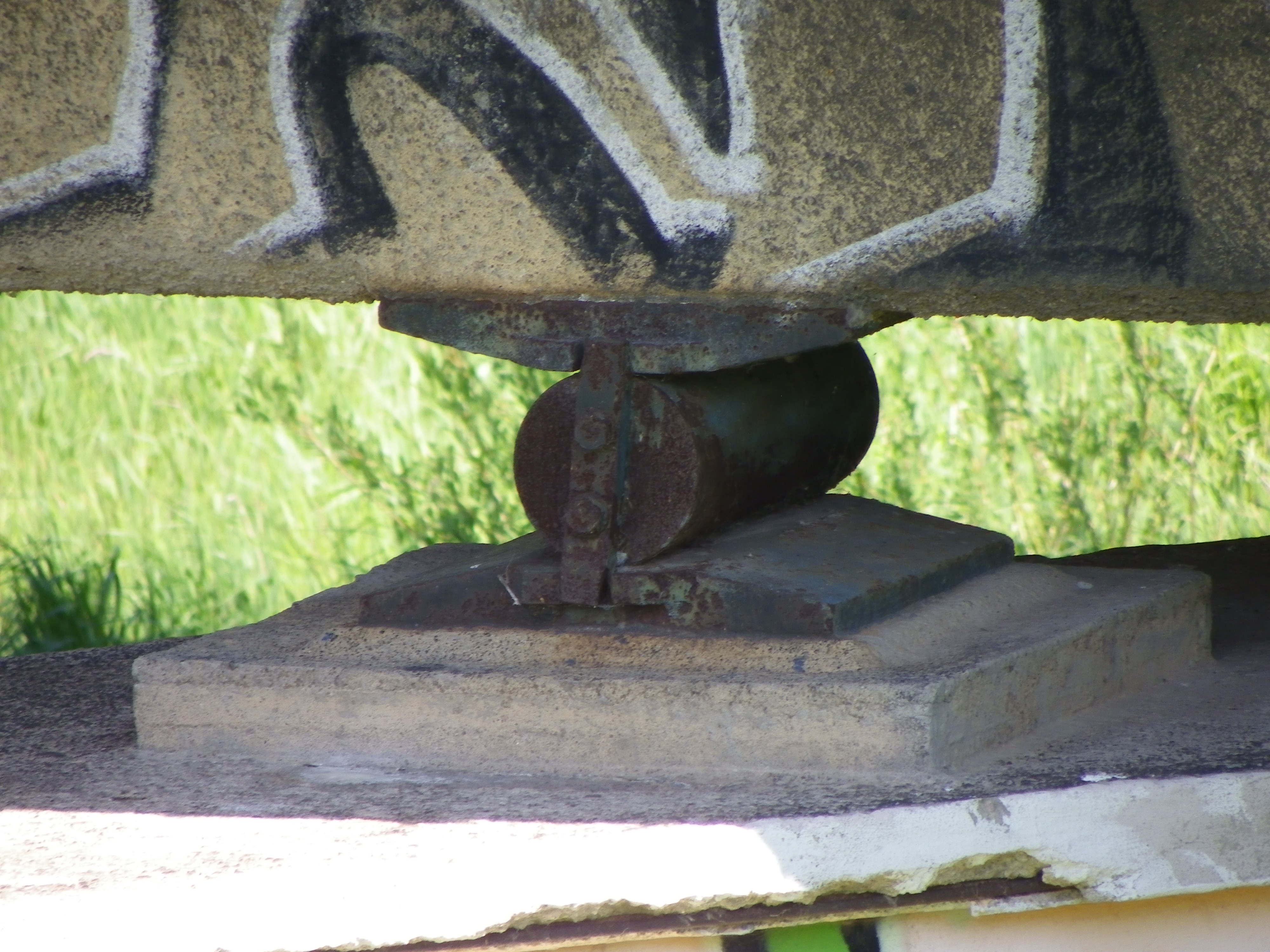
Expansion Device: The Roller[/caption]
******
[caption id="attachment_345" align="alignnone" width="4000"]
Meerane Bridge[/caption]
Meerane Bridge:
Located over the Flutgraben at the junction of Meeraner Strasse and Sachsenallee, this bridge was one of the first to have been built at this location after the diversion canal was built. After the Flood of 1858, the city council decided to construct the canal to divert water away from Glauchau, despite successful attempts by Heinrich Hedrich to construct the first drainage system in Germany serving the city. A wooden bridge was built to cross the area where the canal was being built, yet was replaced with a steel trestle at the conclusion of the canal project in 1890. The bridge featured a Bedstead Pratt pony truss bridge divided into three spans. That bridge was later replaced with a concrete girder bridge in 1949, which was later replaced with its current structure some 50 years later. The cantilever deck bridge continues to serve traffic to Gesau and Meerane to the west and is located next to the sports complex where the soccer team Empor Glauchau has its headquarters. The bridge used to be called the Orphanage Bridge as there was an
orphanage located near the site where the diversion canal was located. Built in 1859, the facility housed orphans for 150 years.
[caption id="attachment_346" align="alignnone" width="4000"]
Jerisau Bridge[/caption]
Spanning the Flutgraben at the junction of Waldeburger Strasse and Hochuferstrasse (B-175 Bypass), this bridge connects Glauchau's northern industrial district with the suburb Jerisau. Before the bypass was built, the bridge carried Highway B-175 through Jerisau enroute to Waldenburg, seven kilometers northeast of Glauchau. The Bypass was built to alleviate traffic and to provide better access to the Autobahn 4. The present bridge, a concrete cantilever span, was built in 1998, with a length of 97 meters- 15 more than its predecessor, a five-span concrete beam bridge built in 1949. This bridge may have followed the footsteps of the Meerane Bridge in terms of the types of bridges that had been built and replaced since the diversion canal was built in 1890.
[caption id="attachment_329" align="alignnone" width="4000"]
Leitschutzdamm[/caption]
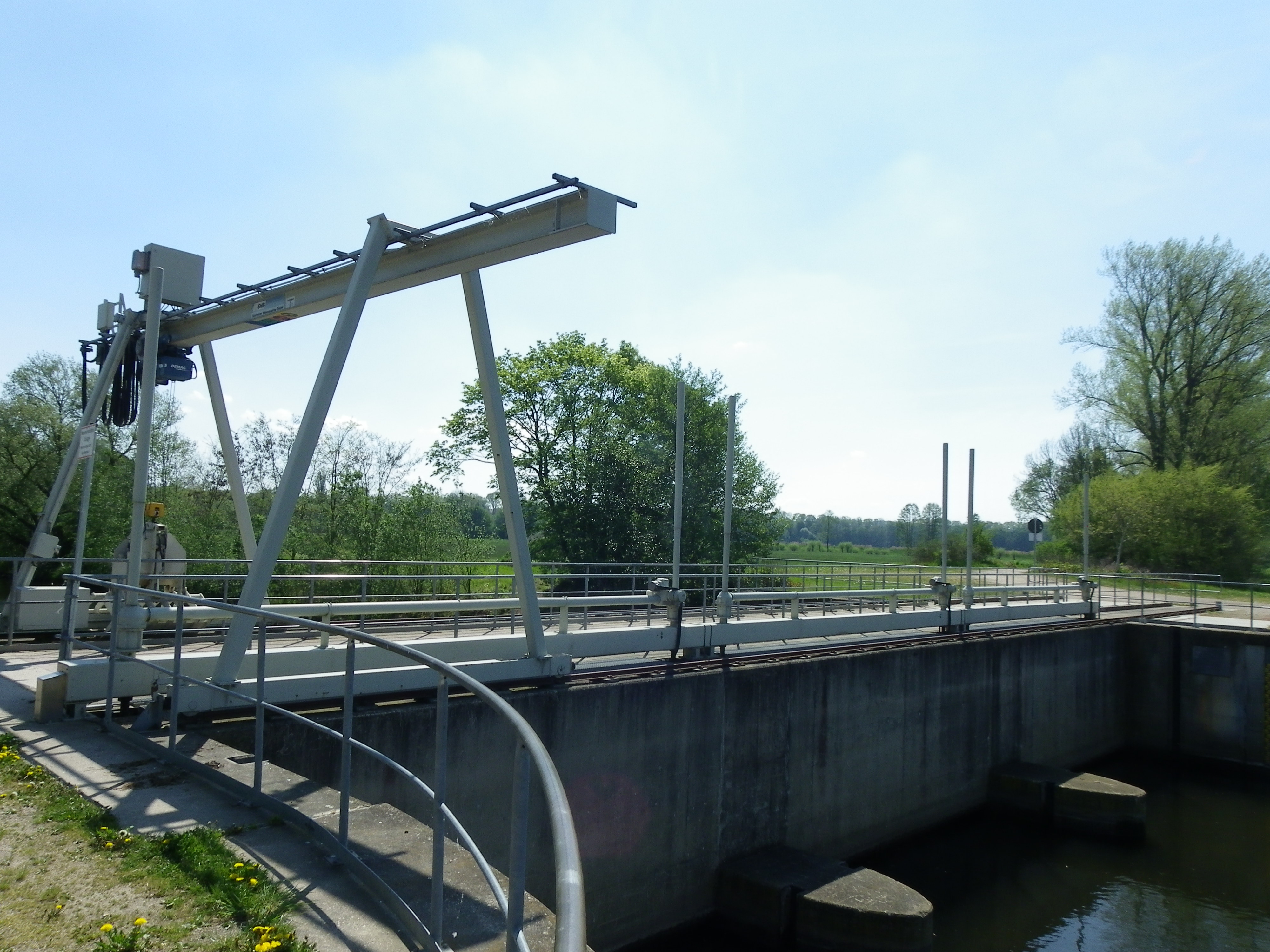
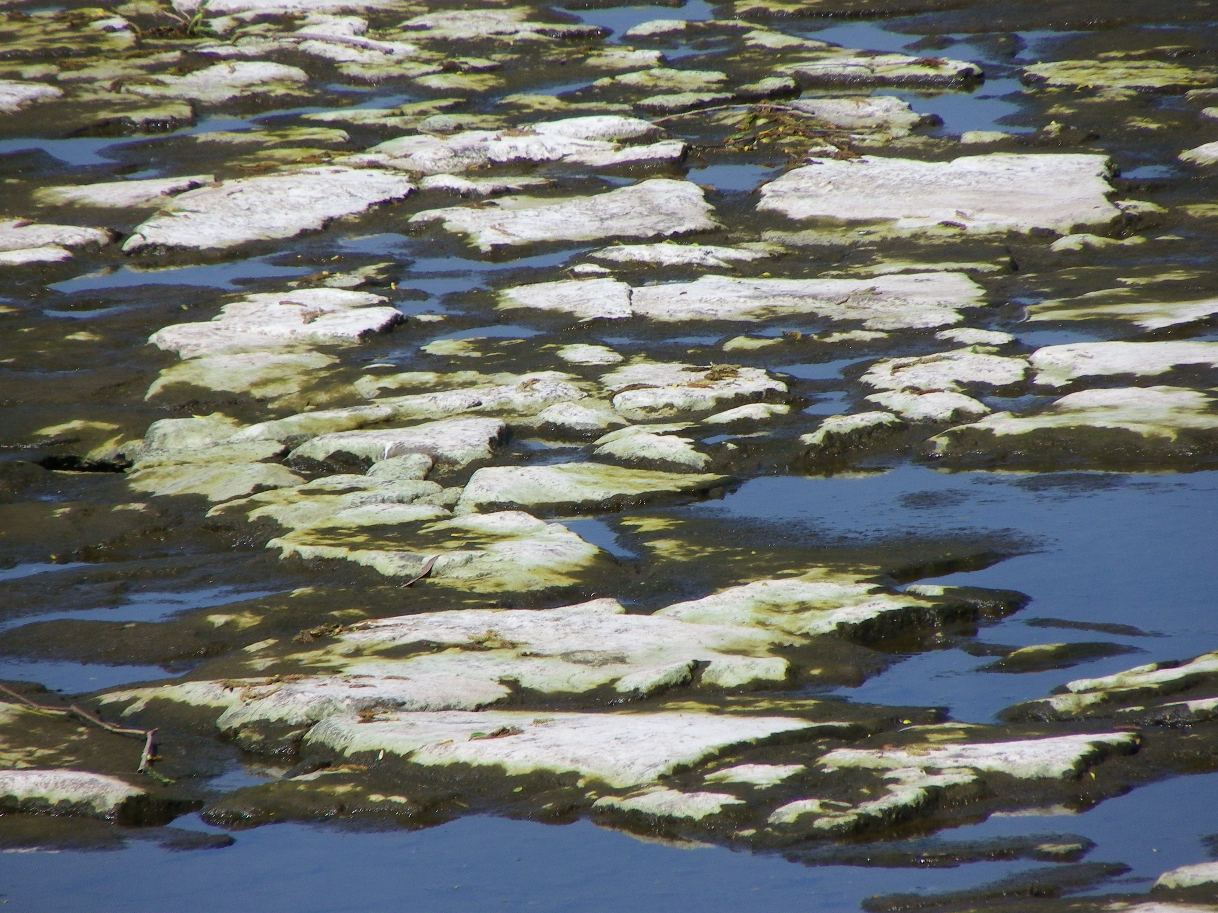
Leitschutzdamm at Glauchau Reservoir:
Located near the Glauchau Reservoir, this dam was built for the purpose of rechanneling the Mulde in the event of flooding. That means all excessive water flow through the dam and along the outer channel, alleviating the flow of water along the main river going through town without flooding it. Despite being built in the 1980s, sources indicated that a previous dam was built in the early 1930s, possibly replacing an even earlier one. When water is diverted towards the town, one can see some unique patters in the channel bed when little water is flowing, as seen in the pic below. The dam acts as a crossing, enabling cyclists and pedestrians to go in the direction of the southern countryside.
******
[caption id="attachment_342" align="alignnone" width="4000"]
South Dam and Bridge[/caption]
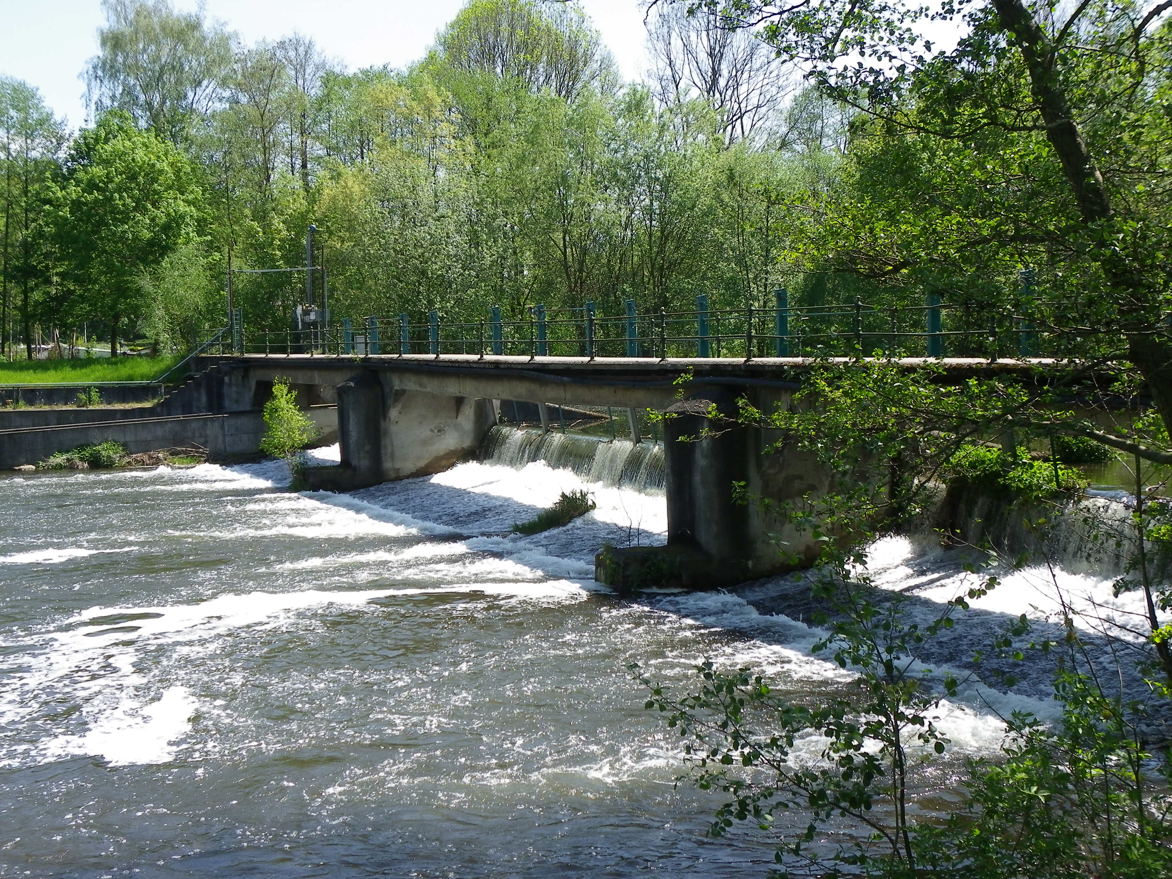
South Dam and Bridge:
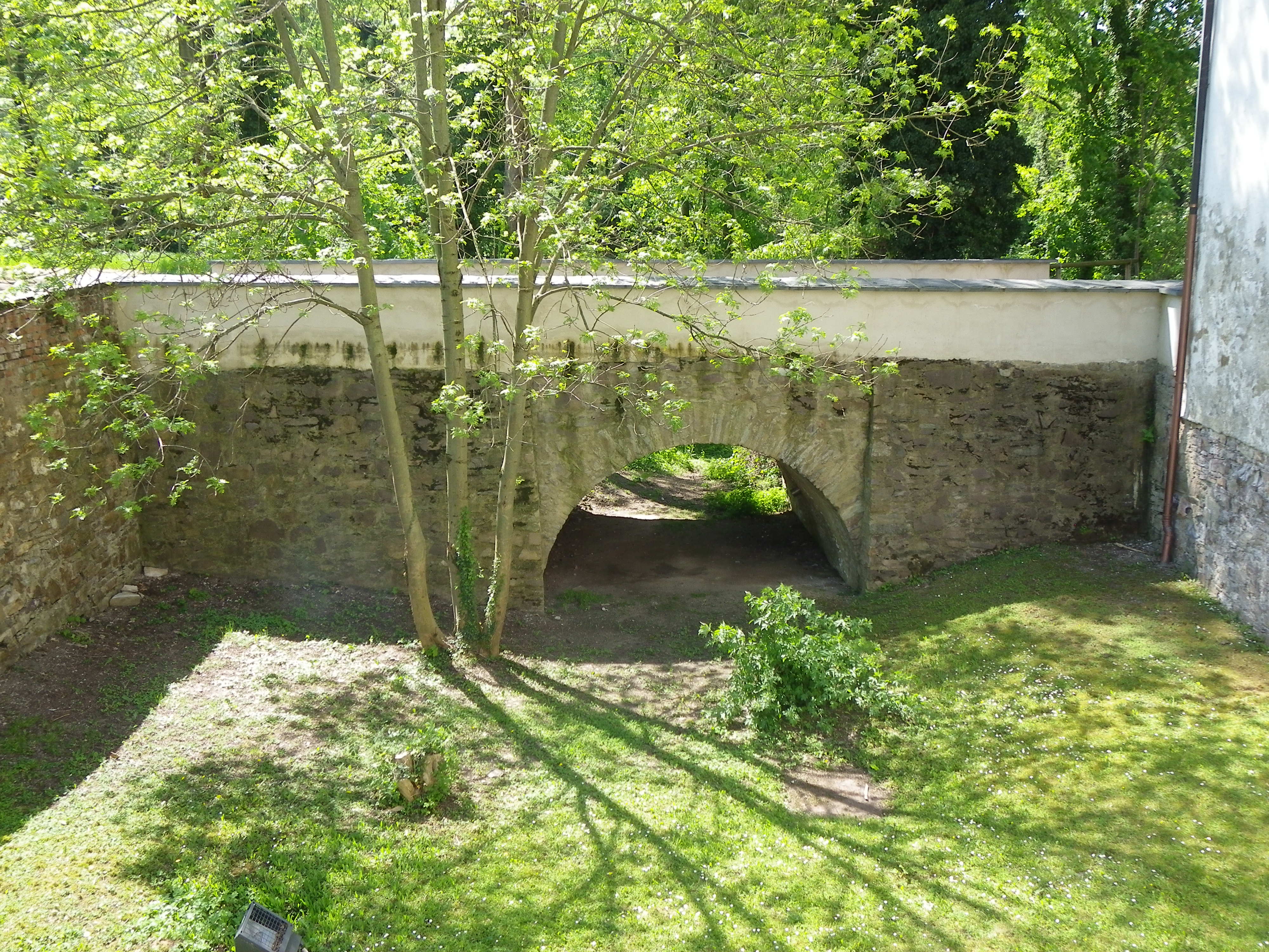
Located over the Mulde at Wehrstrasse, west of Grundelteich, this bridge is one of the oldest in Glauchau, having been built in the late 1890s. This is recognizable with the cast iron railings and its approximate location to the mill and an unusual water silo. It is possible that this bridge was one of four built by Hedrich, but more information is needed to confirm these claims.
[caption id="attachment_338" align="alignnone" width="3000"]
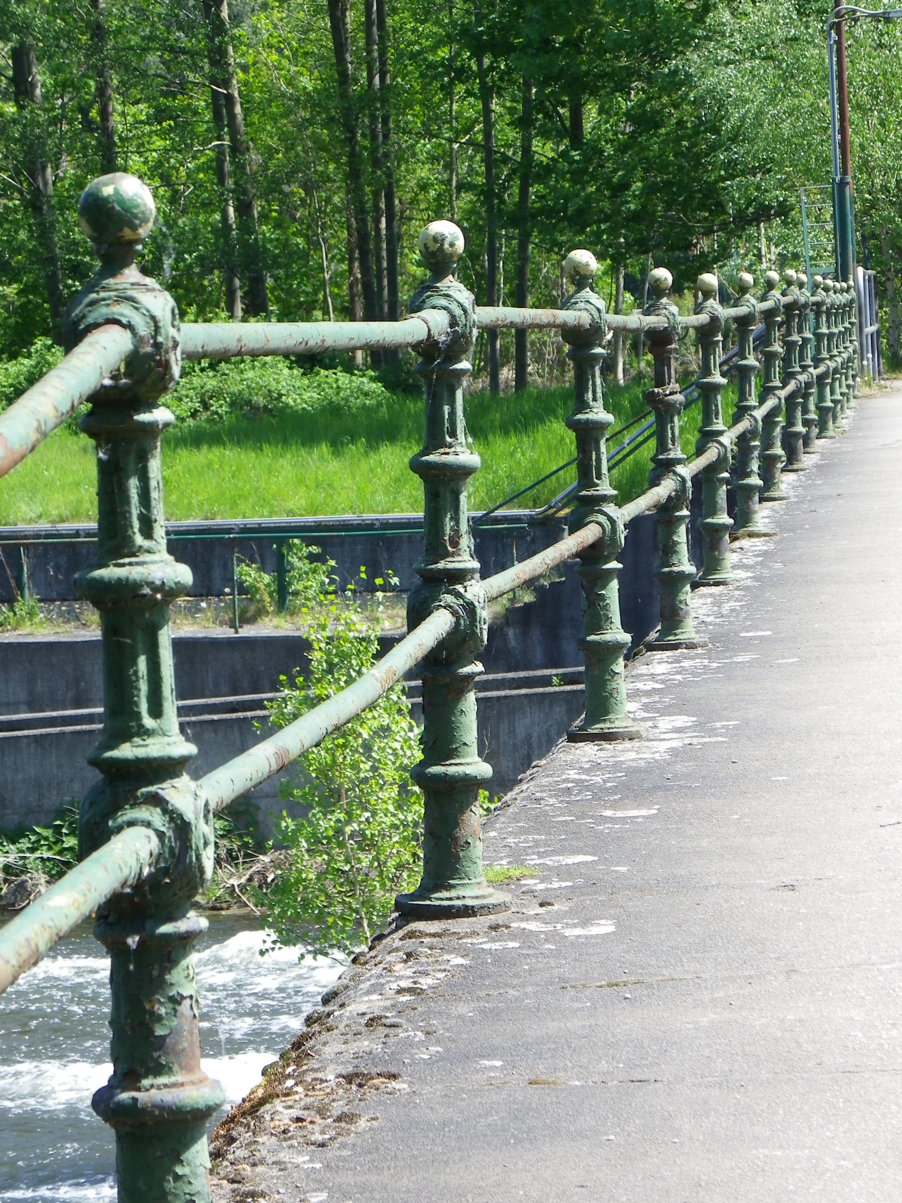
Close-up of the cast iron railings[/caption]
******
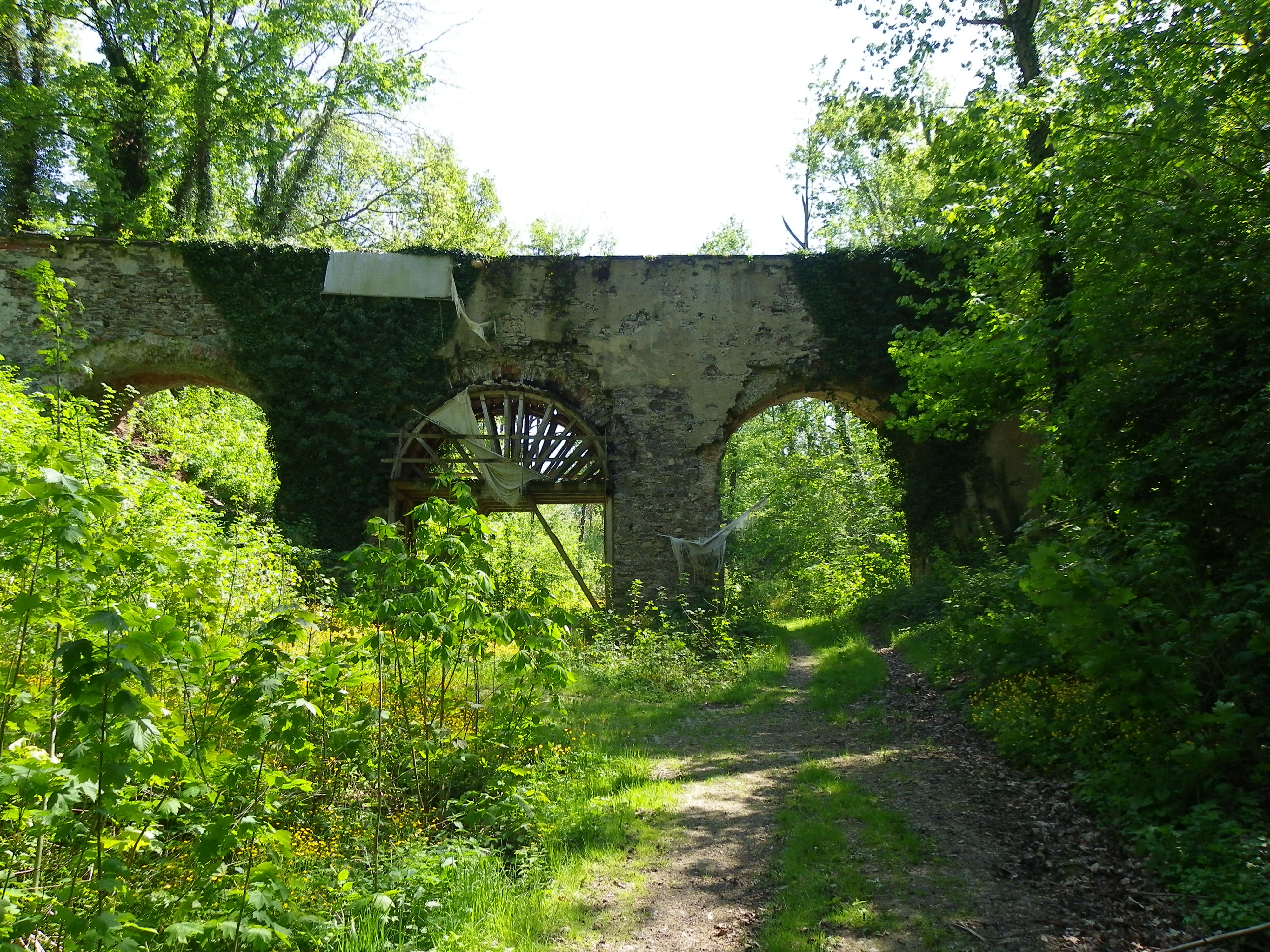
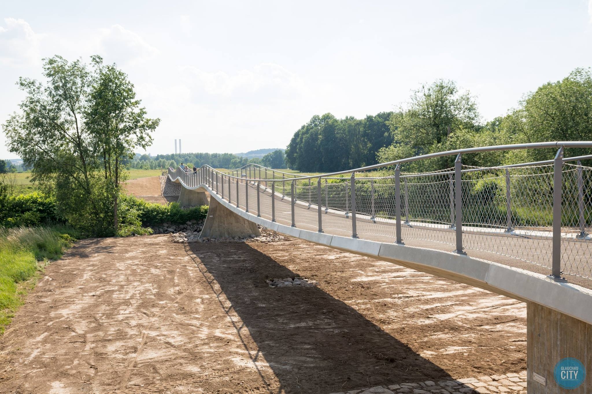
Wernsdorf Wave Bridge:
This bridge, spanning the Mulde in the southern suburb of Wernsdorf, was one that was completely missed while on tour. The reason: Upon arrival at the crossing, I found the bridge to not exist anymore. I later found out in my research that the bridge had been removed due to structural concerns. In addition, as the region was prone to flooding, dikes needed to be reinforced to keep the waters of the Mulde from flooding the corn fields. Prior to its demise, the Chemnitz Free Press wrote a eulogy about the structure and its time as a crossing, which can be summarized as follows:
The bridge was built in 1954 to replace a wooden bridge that had been washed away by flooding. It was a simple beam bridge of six spans, built of concrete and steel, and had once been used as main traffic between the village of Wernsdorf and all points going to the south and west. After sustaining damage by the flooding in 2013, the structure was closed to all traffic, and officials in Wernsdorf and Glauchau worked on a plan to replace the bridge as it served as a vital link, not just for cyclists and locals, but also for farmers. After the plan for a new bridge had been unveiled,
the old structure was demolished in April 2016. Despite delays in finishing the project, due to unfavorable weather conditions and the construction of a new bike path connecting the structure with the sports complex, the bridge was
dedicated to recreational traffic on 20 June, 2017. Currently, the Wernsdorf Wave serves bikers, equestrians and walkers and is part of the Mulde Bike Trail network again, re-establishing a link between Glauchau, Wernsdorf and neighboring villages to the south.
******
As one can see in the pics, the philosophy holds true regarding historic places in a community. Glauchau may be considered a ghost town with little or no activity, a town with two castles and a well-networked school system educating people from different nationalities, a farming community, and one laden with places of Christianity. However, in my visit, I found out by chance that the town is laden with diamonds in the rough as far as history is concerned. No one (on the outside) knew about Heinrich Carl Hedrich's contributions until my visit, let alone the bridges with either a vast amount of documented history or a potential of finding some history about them. Sometimes it takes some tours with the bike and a good camera to find out the sides of a community that no one knew about. With Glauchau, there was more to know about the town than before, and when viewing these bridges, perhaps others will be willing to contribute to the history of the community in western Saxony. :-)
For more on the places visited in Glauchau, there are a couple useful links that are of use:
Map of Glauchau and the Bridges:
[googlemaps https://www.google.com/maps/d/embed?mid=1tAy5BvnAIw6hQ2jg3c2CDQP9HTg&hl=en&w=640&h=480]
Gallery of Photos of the Places in Glauchau, which you can see here:
https://www.facebook.com/media/set/?set=a.1149254905105157.1073741854.100000619742271&type=1&l=61ee592055
Glauchau's Christmas Market courtesy of The Flensburg Files:
https://flensburgerfiles.wordpress.com/2016/12/15/2016-christmas-market-tour-glauchau-saxony/
The author would like to thank the City of Glauchau and its office of planning, Ulrich Schleife and the crew at Glauchau-City for their contribution to this tour guide. Without your help, we would not have found out more about the city's bridges than what I discovered as a photographer and pontist. May God bless you for your help. :-)


